Services
Mapping & Surveying
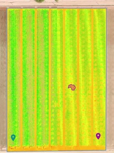
NDVI of Sweet Corn
NDVI
Normalized Difference Vegetation Index
Great to check up on crops, with a NDVI map.
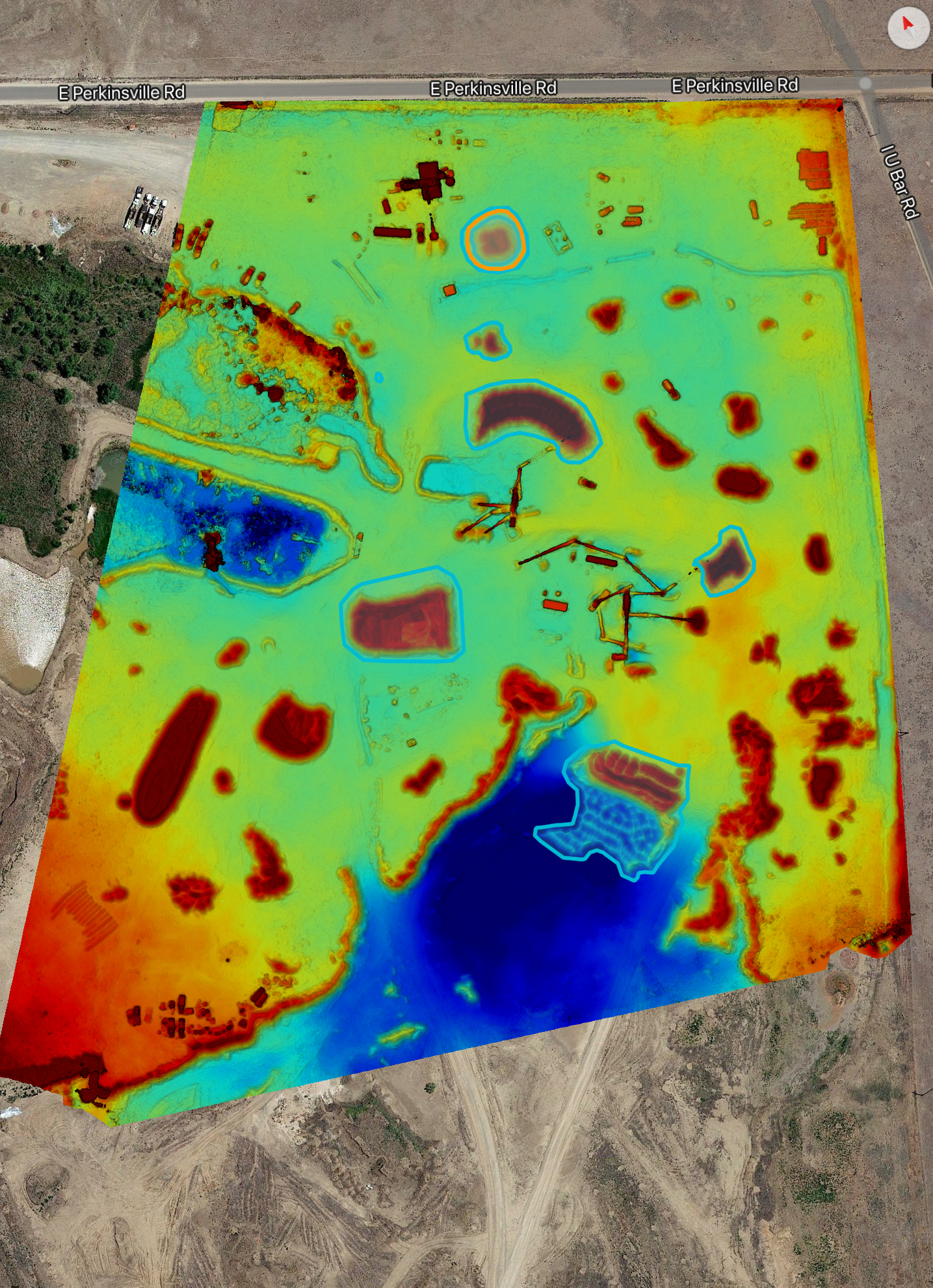
Mine site revealed
Topographic
See what the lay of the land is with a topographical map. Measure Cut/Fill operations. Measure distance or even get a handle on what is in your stockpiles.

Silo roof. Safe way to take a look!
Progress Reporting and Inspections
Check on Construction projects, or on your Mining operation. with images, or have it mapped to measure cut and fill operations. Quickly measure what is remaining in those stock piles.
Or Inspect the condition of Windmills, towers, roofs, and so much more.
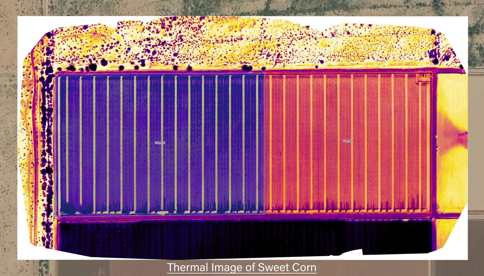
Thermal Image of Sweet Corn!
Thermal
Thermal can be used for numerous types of work. Used frequently in electrical, solar, home efficiency, agriculture or even gas leak detection. Anything where temperature needs monitored.
Photography & Videography

We can create whatever you need!
Commercial & Advertisement
Real Estate pictures, videos, and much more. have a custom advertisements or even commercials made with aerial footage.
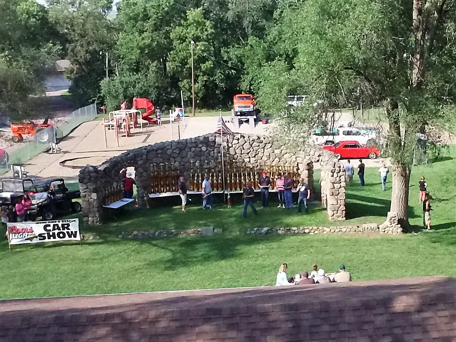
2017 Irene SD Fire & Rescue Car Show
Events
Showcase your event or just get a great picture of the whole gang! here is a shot of the trophies to be awarded at the 2017 Irene SD Fire & Rescue Car Show
Specialty
We can also accommodate other specialty requests. Please contact us to discuss your needs.